
Trip Report 6/12/26
Arapaho National Forest
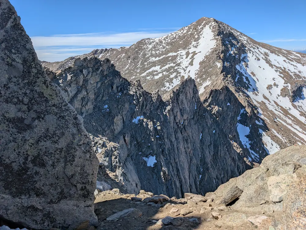
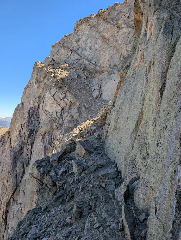
The catwalks around the Sawtooth were incredibly exciting, and this rugged ridge line was easily the highlight of the day. Stepping off the summit of Mount Bierstadt toward the jagged spine of the ridge, the crowds instantly vanished, and the intensity of the route cranked up. With Class 3 scrambling, lingering snow patches to cross, and some fantastic exposure dropping off into the drainage below, the traverse was tedious and actually took longer than the entire climb up Bierstadt. But once I popped out of the Sawtooth, the landscape wide opened, and I began the long grind toward Mount Blue Sky.
Tapping these two summits brings me to my 12th official 14er. Standing up here, I thought a lot about my college days at the University of Denver. Somehow, during those four years, I never once climbed a 14er—let alone a 13er. In hindsight, it feels like a missed opportunity, but as the saying goes, youth is wasted on the young.
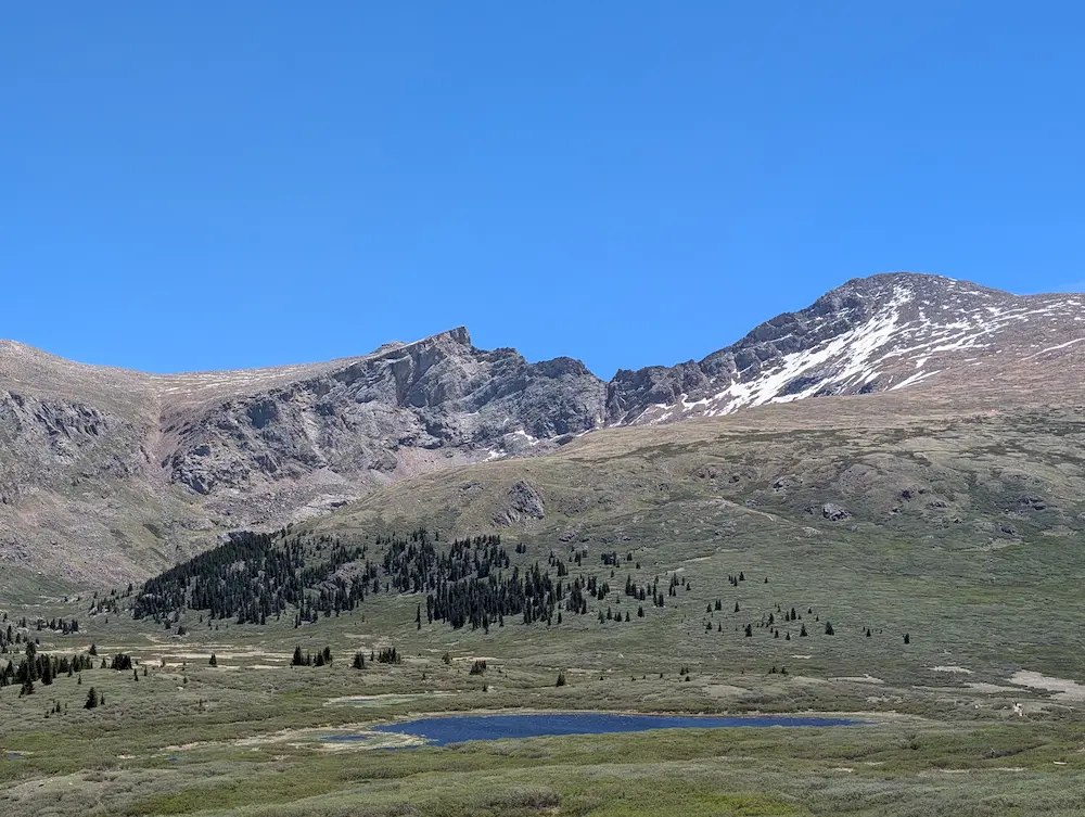
The day started with a bit of a culture shock. After a few days of total peace and quiet on the back routes of the Sawatch and Mosquito ranges, the scene on Bierstadt was abrupt. Arriving at Guanella Pass early, there was already a steady stream of hikers heading back down the trail by 8:00 a.m. Parking was full and the trail was busy. Still, it’s always good to see people out enjoying the mountains when possible.
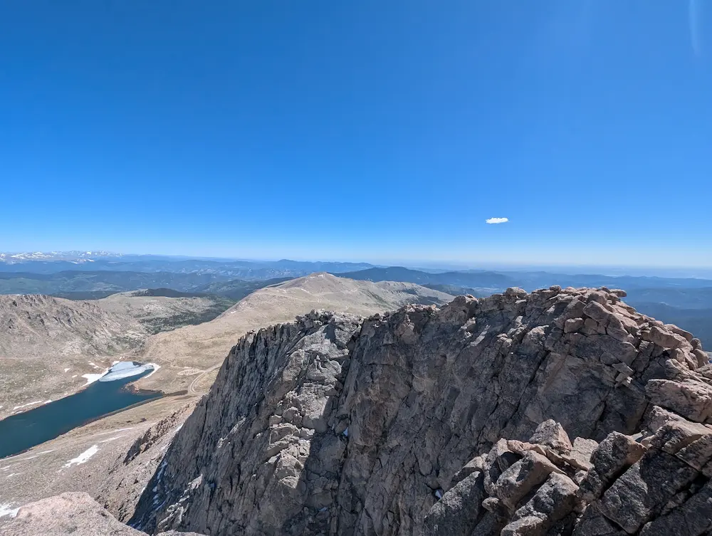
Once across the Sawtooth and onto the Mount Blue Sky Ridge Trail, the route contours just below the crest to the south, well-marked with rock cairns. It’s highly recommended to follow these closely, as the mountain throws three or four false summits at you on the way to the top. Once the paved summit parking lot appears below, the true high point is just above. The top is remarkably exposed, especially considering it’s accessible to anyone who can make the drive up the highest paved road in North America.
Another day of heavy, cold wind kept me from lingering at the summit, so I quickly turned back. For the descent, I used the Scott Gomer Creek gully, which drops steeply off the flats back toward Guanella Pass. Once out of the rocky gully, the trail immediately became snarled in thick, head-high willow brush and swamp. Navigating almost a mile of this wet drudgery was a chore, and keeping track of the actual path through the mud was tough in places. The Gomer gully trail joins the Mt. Bierstadt trail about a half mile from the parking lot. From here its home free.
As my itinerary shifts from the Mosquito Range deeper into the Front Range, the underlying rock has turned to solid granite and the scenery changes daily. From the top of Blue Sky, I could see clear across the Indian Peaks all the way to Longs Peak. Tomorrow, the stakes get a bit higher as I meet up with my friend Luke for an attempt on the Keyhole Route.
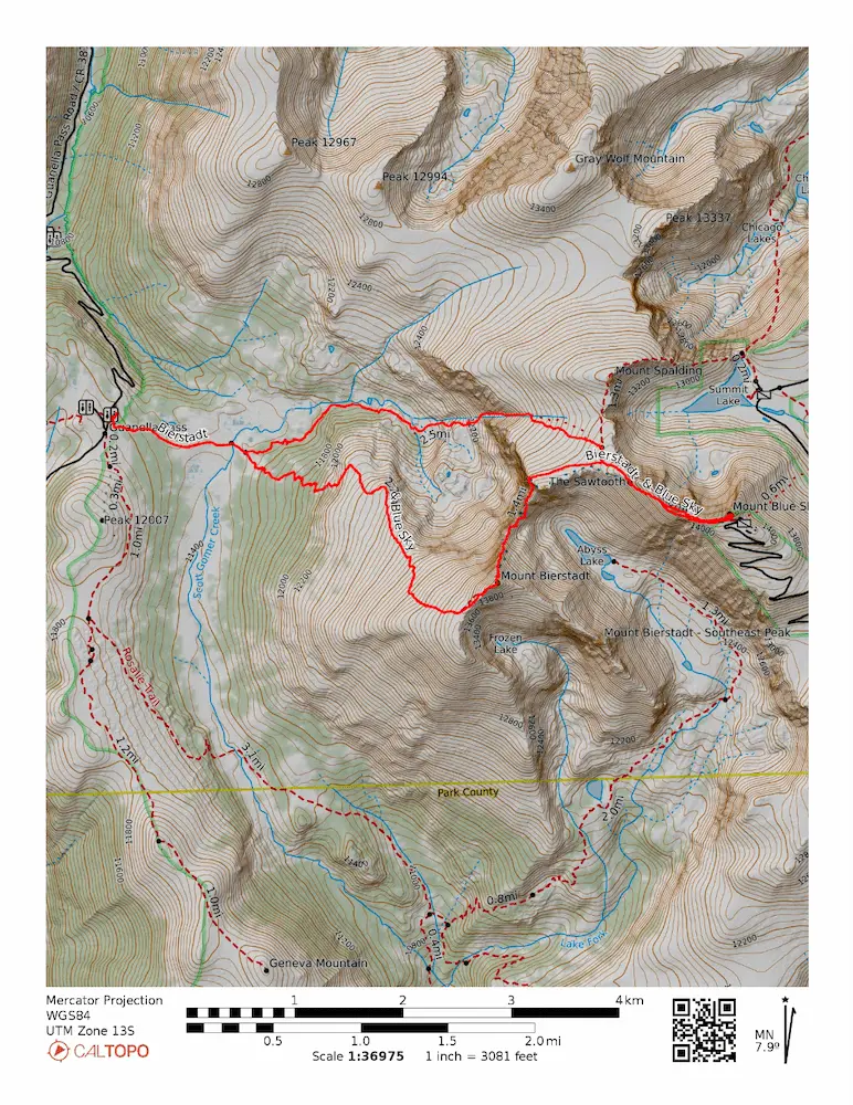
🗺️ Line of Travel:
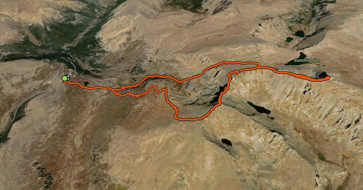
Mt. Bierstadt Trailhead ➔ Mt. Bierstadt Trail ➔ Summit Bierstadt ➔ Sawtooth Ridge Traverse ➔ Mt. Blue Sky Ridge Trail ➔ Mt. Blue Sky Summit Trail ➔ Summit Blue Sky ➔ Mt. Blue Sky Ridge Trail ➔ Gomer Creek Gully Trail ➔ Mt. Bierstadt Trail ➔ Mt. Bierstadt Trailhead.
📍Beta:
- The Sawtooth Ridge is a legitimate step up from standard walk-up 14ers. Expect sustained Class 2 and mandatory Class 3 scrambling with major exposure. Route finding can be slow.
- The standard return loop via the Scott Gomer Creek drainage features nearly a mile of notoriously thick, muddy willow swamp. Expect slow going, wet feet, and a bit of path-finding challenge even in mid-summer.
- Blue Sky’s summit ridge is famous for its multiple false summits. Keep an eye out for the cairns rather than pushing straight up the initial high points.
📊 Route Stats:
- Distance: 10.46 miles
- Elevation Gain: 6,020 feet
- Moving Time: 3:03:38
- Elapsed Time: 3:59:52
- Average Pace: 17.32 / mile
👟 Gear List:
- Shoes: Dynafit Ultra Pro 2
- Pack: Black Diamond Distance 12 Pack
- Water: MSR Trailshot Pump

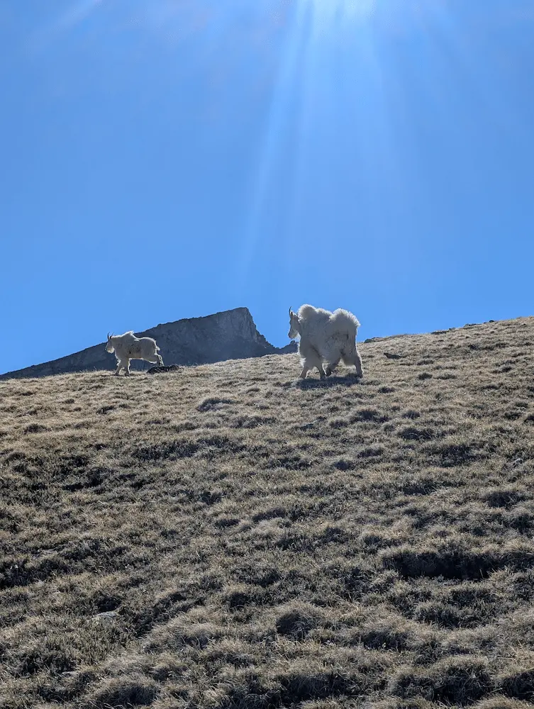
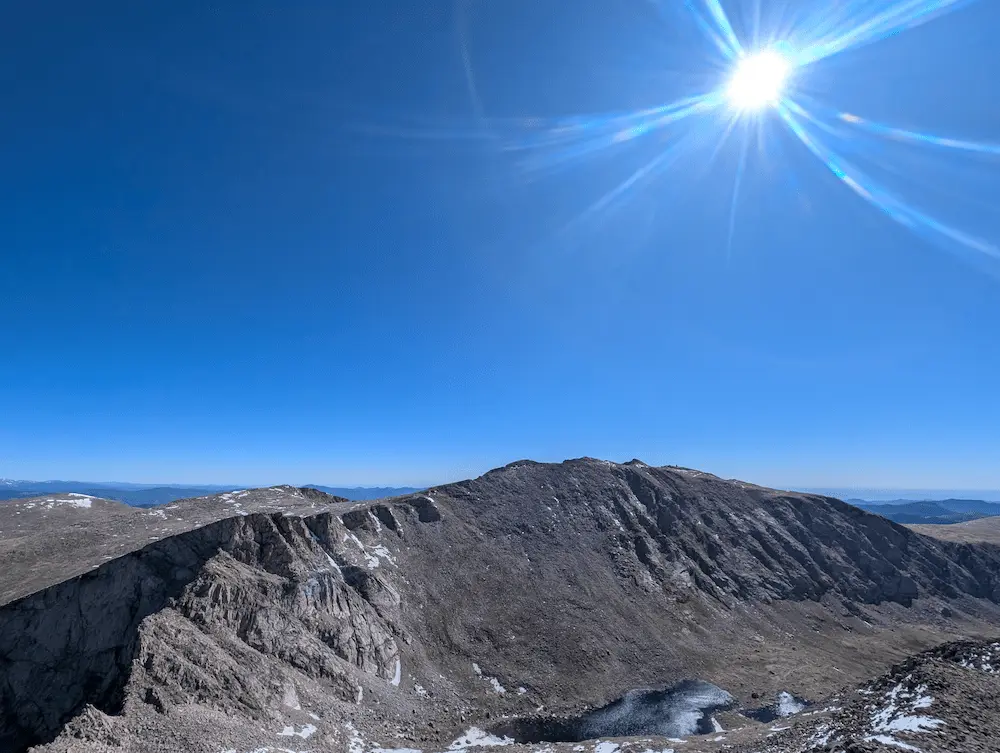
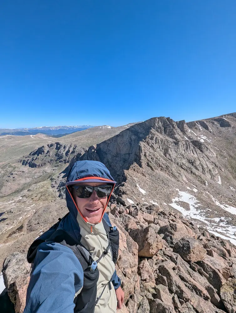
Mt. Goats, Mt. Blue Sky and Abyss Lake, Sawtooth Ridge, Catwalk on the Sawtooth
Member discussion: